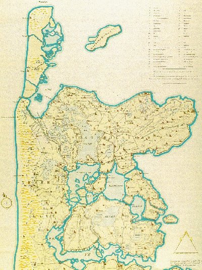
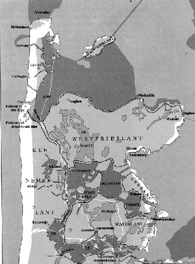
Around 1400 was
Noordholland an area between the North Sea and the South
Sea (now IJssellake) with many lakes. During the Middle Ages
Holland was one of the most important trading countries and
many traders earned a lot of money. Since even in that period
land was scarce in Holland they decided to finance the
reclaiming of land by means of windmills. Successively many
"polders" were created: a.o. the Purmer, the Beemster, the
Wormer and maybe most famous the Schermer. If you compare the
present map with the (reconstructed) map of 1388, you can
see the enormous developments that have been made in our area.
The darker part of the map represents the present
situation.
Due to the difference in height between the water in the
polder and outside (often 7-8 meters = 8 - 9 yards) mills were
used at three different levels. Regretfully many
mills were taken down in the thirties, although there are
still more than 20 mills within 10 km of Ursem. If you are
interested to know more about this, give me an email and tell
me what you're specially interested in. I will try to answer
your questions.